
MAP of ZIP CODES
Zip Code Map Designers


3 Digit Zip Code Maps and Customizable Sales Territory Maps of the USA States and Zip code Region Maps and Heat Maps
MAP of ZIP CODES
Zip Code Map Designers
Every company operates differently. There's no reason to stick to mainstream software when 90% of the features aren't relevant to you. We've worked with dozens of companies to create fully bespoke software that fulfils their companies needs perfectly. Many of our tools are centred around interactive maps with complex data analysis features.
As well as custom software we have created lots of small tools that help with many small repetitive tasks. Nobody enjoys repetitive task that wastes their time every day. Most of our smaller tools were created as a way to save ourselves time. After testing and updating these tools we simply polished them up and made them available here.
If you have a task you think could be automated or a tool you think would benefit your business please get in touch with us. We'd love to discuss ways we can help you.
The United States is split into many different zones and territories, from States, to 5-digit zip codes and counties. All of this information is used in different ways in different companies. Larger companies may divide the country into specific areas to show where their branches are located and the area they cover. Smaller businesses may use USA maps to help their sales people cover the right areas.
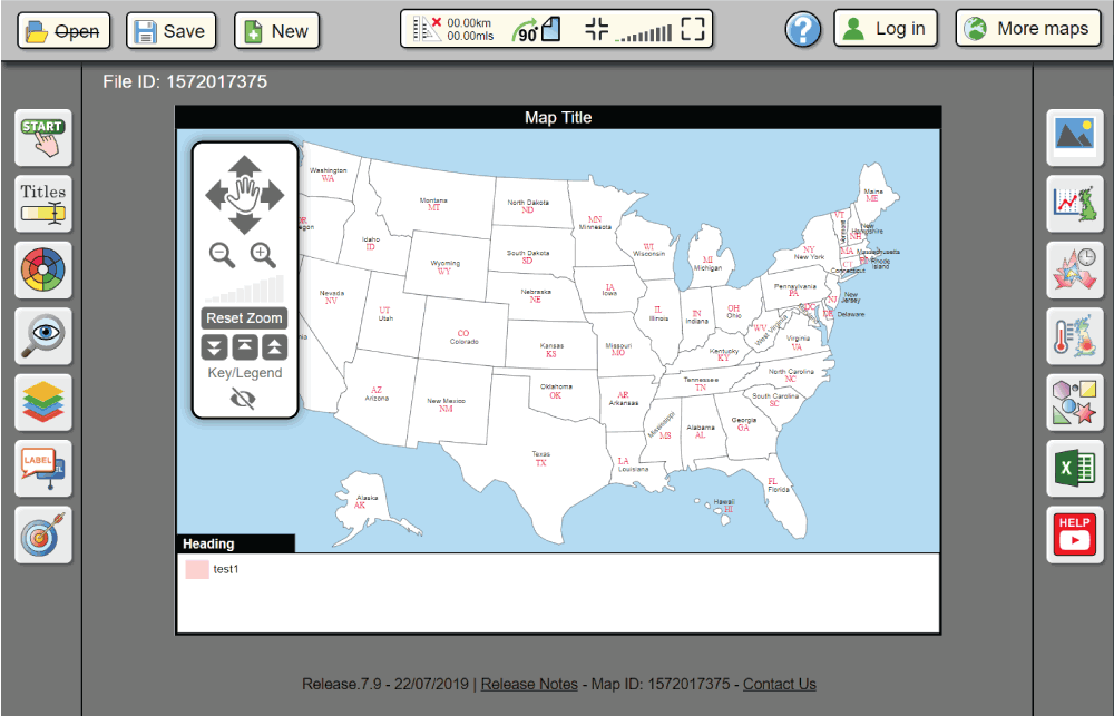
Our State map is exactly what its name describes. Our bespoke mapping tool will allow you to colour a map of the US, split up by state boundaries. Multiple headings, circles, location markers, shapes and additional data sets can be added to show your information much easier.
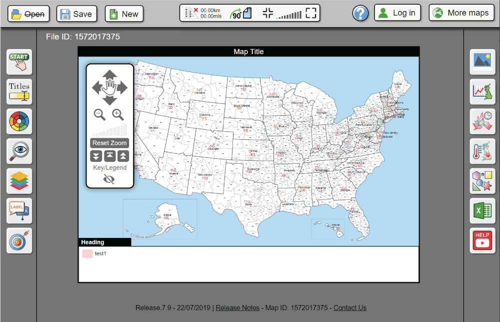
Our next most detailed America map is the 3-digit zip code map. This map is split by states before being split further into 3-digit zip codes. This map can be colored by either state or zip code. After adding headings and coloring this map as desired you will need to save it. Our system gives every user an account where you can save as many maps as you want for the purchased amount of time.
Maps can be saved as GBM, which is the file format for our system, PDF, CSV, SVG and PNG. This system works from a vector map of the country meaning that, once edited and saved as a PDF, the file won't lose any resolution no matter how large it's printed or how close you zoom in.

America has a total of 3,007 counties and county-equivalent areas. These include 3,007 actual counties, 16 boroughs, 11 census areas, 64 parishes, 42 independent cities and 1 district. Not including commonwealths and territories. All of these counties are included on our editable county map of the United States. This map is initially split by states and then again by counties, all of which is colour editable.